- Refreeze overnight; More melting Monday
- Another round of frigid air arrives Tuesday
- Tracking weekend storm system
TONIGHT
Tonight will feature lows in the teens and 20s under a mostly clear sky.
MONDAY
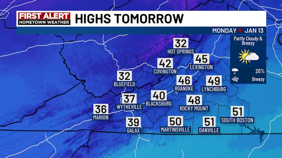
The warming trend continues into Monday. Expect highs in the 30s and 40s west of the Blue Ridge and upper 40s to low 50s east of the Blue Ridge. The breeze, however, will return as a cold front crosses the region. Wind chills will top out in the 30s and 40s for most hometowns.
FIRST ALERT: MOUNTAIN SNOW SHOWERS
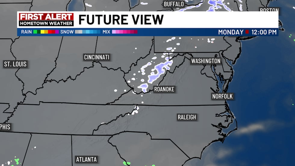
A few mountain snow showers are possible on Monday. Some flurries can’t be ruled out in the valleys the breeze returns by the afternoon.
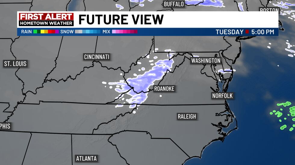
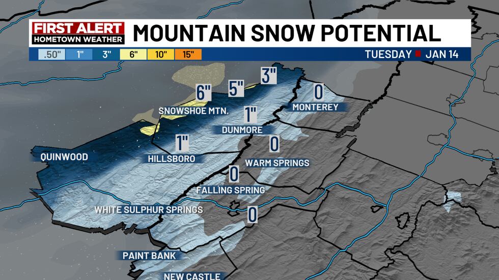
By Tuesday, a second cold front will cross the region. This front will have more moisture with it, increasing the chances of accumulating mountain snow.
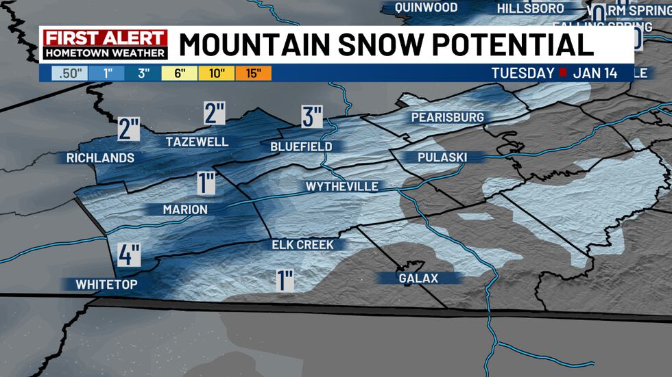
Here’s a look at the snow forecast for hometowns along/southwest of I-77:
Here’s a look at the snow forecast for the Alleghany Highlands and Greenbrier Valley:
FIRST ALERT: NEXT BIG THING
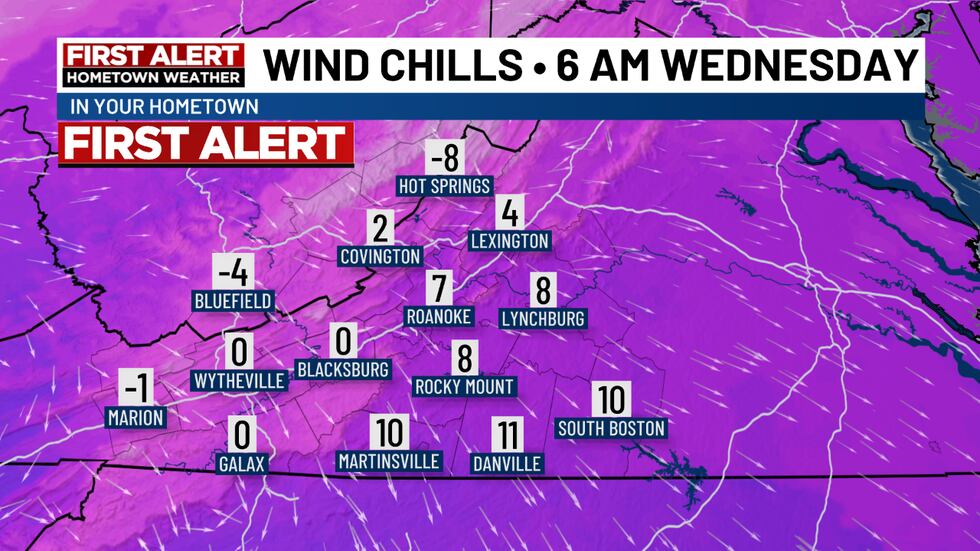
Now that our second winter storm of the season is over, we’re already tracking our next Big Thing. A blast of arctic air will rush into our hometowns Tuesday into Wednesday.
Here are the forecast wind chills for Wednesday morning:
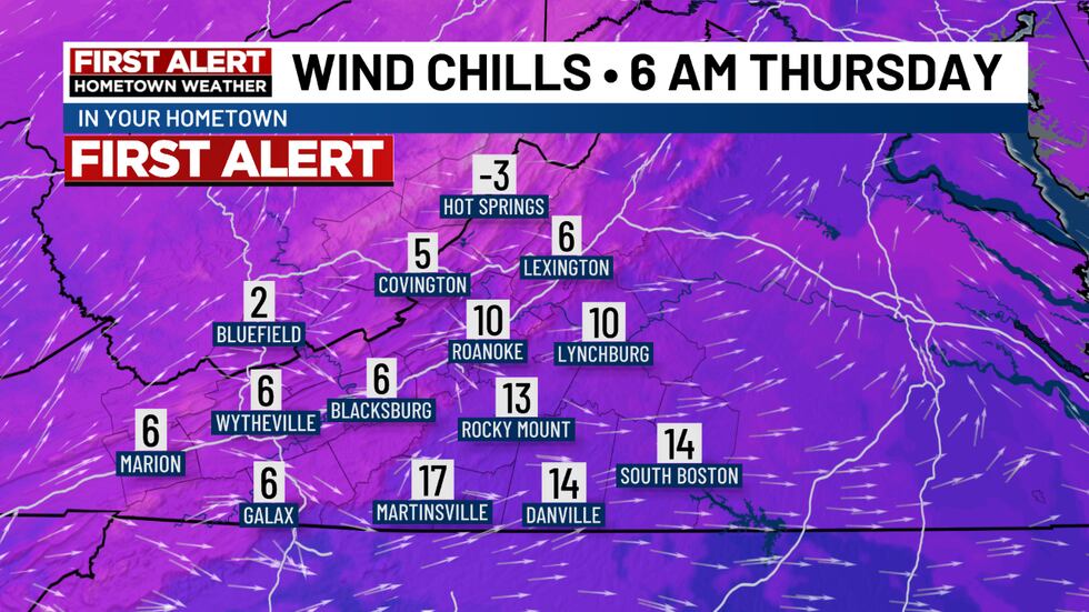
Here are the forecast wind chills for Thursday morning:
LOOKING AHEAD
This has been one of the coldest Januarys we’ve had in years. It currently stands in the Top 10 coldest for the Roanoke Valley and other areas.
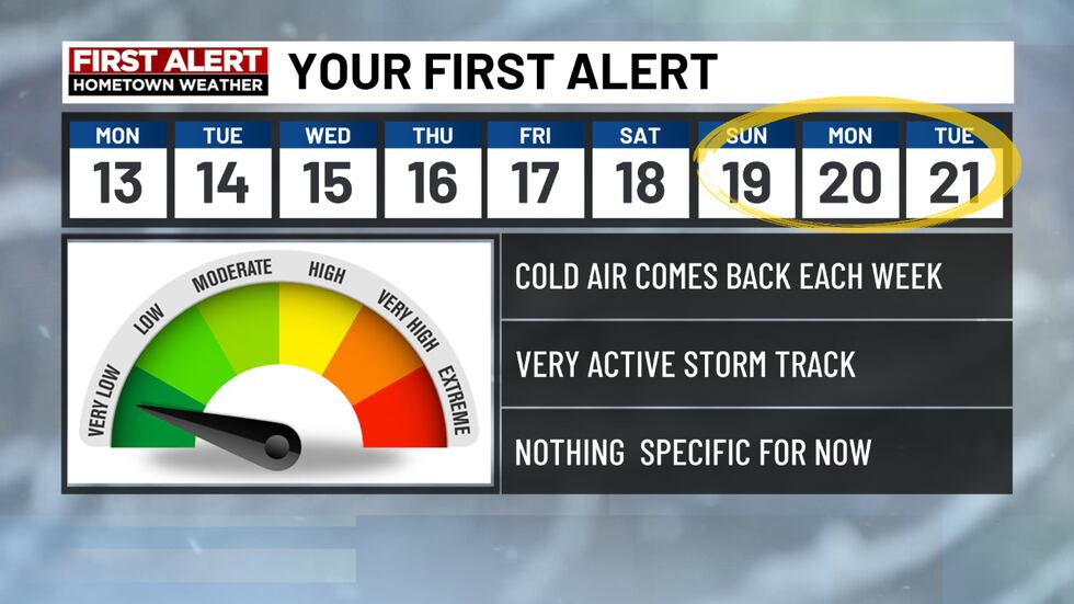
More cold arrives later this week, but that’s not all. We’re watching several shots of frigid air dropping south out of Canada in the weeks to come. Each one will need to be monitored closely, as any developing storms could bring the opportunity for more wintry weather.
It looks like we’ll take a week off from any storm chances, but the following week will need to be monitored closely.
While there’s nothing specific at this point, we remain in an active storm pattern where anything that develops has the potential to turn wintry thanks to the cold air.
The odds of more wintry weather at some point during the second half of the month are higher than normal.
Copyright 2024 WDBJ. All rights reserved.

